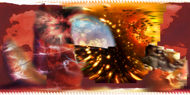
Started work on Gallifrey map v2, now with more visual references. >:)
It’ll also be much more detailed - I’m hoping to try using fictionalmaps.com to make a zoomable version, even though most of the planet other than the Capitol/Prydonia and Arcadia will be empty of detail, unless I or someone else does some fanon worldbuilding for regions like Anarcos or Capari where we have little more than a name.
Background is my previous version, which I’ve been using as a reference for working out placements and stiching parts together. Main goal is to use the new sources to help fill in the parts where I had to rely purely on descriptive sources (ie. most of Wild Endeavour).
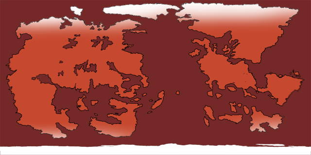
Here’s my original sketch map for v1, for comparison:
If you’re wondering why I’m not using End of Time or Tecteun’s story in The Timeless Children, at this point I’m working on the assumption that the ‘surface’ seen in those is the Transduction Barrier (which has some interesting timeline implications for Rassilon’s era). Hence why it glows so much in both, plus why Gallifrey’s so huge in the prior when most sources suggest it’s roughly Earth-size. This is also why neither show visible oceans/landmasses but other sources do.
I could use the ship-approaching scene from Invasion of Time, but based on the star movement we only actually see a very small part of the surface in that.
Actually was able to add another shot from EVE Online, to shape the south of Wild Endeavour a bit more, as well as the south pole:
With that in mind, here’s my very rough initial sketch of the continents (you can see where I’ve smudged it to tweak shapes and sizes). I made some small tweaks compared to the sources to allow for spherical artefacts, lighting, compatability with other sources/descriptions, but I think it matches up to the above pretty well:
Will be expanding on this of course. Here’s my to-do list: