#storm chasing
Hundreds of storm chasers pay tribute to late actor Bill Paxton by spelling out his initials using GPS coordinates. http://abcn.ws/2l2onR8

All ready for you… reblog and inbox me
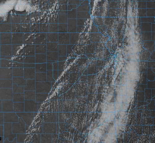
Watching this cumulus field across KS into northern OK for possible severe storm development this afternoon. This is likely the place where the most chase-friendly storms will occur today if they can form and sustain. https://www.facebook.com/TornadoTitans/photos/a.452467798157080/7358209934249464/?type=3
Post link
As expected, the first piece of June will likely be on the active side for storms/severe weather. The details on each day will vary a lot and will change, but the rainfall totals being thrown out by many models (this is just one ensemble) point to an active storm pattern over the Central/Southern Plains starting this weekend into next week. https://www.facebook.com/TornadoTitans/photos/a.118272271576636/7341819199221871/?type=3
Post link
We wrote about the turn of the month (last few days into June) being a probable hotspot of severe weather activity back on May 8 on the Newsletter. Sometimes the climo models can be right!
We are about to exit the quiet overall May pattern that was also telegraphed for the Central/Southern Plains for much of May as we’ve had a pretty well below normal month in terms of the tornado count so far.
Right now watching the greatest severe weather potential with this upcoming system starting on Sunday in Nebraska/Kansas and drifting south each day through Tuesday. Monitoring! https://www.facebook.com/TornadoTitans/photos/a.118272271576636/7337440022993122/?type=3
Post link
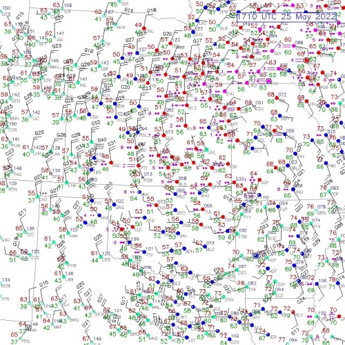
Weirdest Spring ever. The system responsible for our two-days of severe weather in Texas is pulling away with temps only at 50-51 in NW OK/NE TX PH at the end of May.
And next week the ConvT on the dryline will be over 100F once again. Just wild swings. https://www.facebook.com/TornadoTitans/photos/a.118272271576636/7332465793490545/?type=3
Post link
We’ve been talking about the trough the last few days of May into June for nearly 3 weeks now on the newsletter. The question is, will it eject flatter like this current one which hasn’t resulted in a robust severe weather threat or will it eject more amplified and slower which would definitely mean a more robust severe weather threat? We’ll find out in the coming days. https://www.facebook.com/TornadoTitans/photos/a.118272271576636/7312789795458145/?type=3
Post link
Here’s a great example of why hot air (over 100F in Texas) meeting cold air (snow in the Rockies) does not create tornadoes on the Plains typically. That description is an over-simplified explanation of what creates tornadoes and the evidence actually shows it is actually detrimental in many to most cases. https://www.facebook.com/TornadoTitans/photos/a.118272271576636/7295939453809846/?type=3
Post link
The national tornado count remains above average as of today for the year – but the season has flattened out quite a bit since about mid-April. For the Great Plains specifically, only a small fraction of these tornadoes have occurred over the old-school Tornado Alley with most occuring in the Midwest and Southeast this year. https://www.facebook.com/TornadoTitans/photos/a.118272271576636/7292187887518336/?type=3
Post link
SOMETHING WE ARE WATCHING! It looks like the jet stream pattern will turn much more favorable for severe weather by May 19-20 with a chance of that pattern sticking around for a few days thereafter at least. The details matter! But we’re watching this as our next big potential storm chase period coming up. https://www.facebook.com/TornadoTitans/photos/a.452467798157080/7273017586102033/?type=3
Post link
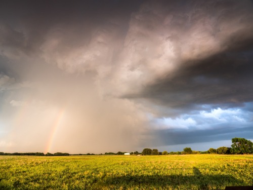
Building storms at sunset in Western Oklahoma in 2018. https://www.facebook.com/TornadoTitans/photos/a.118272271576636/7186564014747391/?type=3
Post link
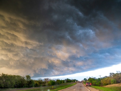
Whale’s mouth feature over US-70 west of Ardmore, OK in April 2014. https://www.facebook.com/TornadoTitans/photos/a.118272271576636/7173220966081696/?type=3
Post link
While there were plenty of garden variety severe storms with hail/wind that frequent the Great Plains – the trend back towards a below average tornado count nationally continued over the last week. While there have been a couple of notable but highly localized tornado events on the Plains, most of the activity this year has followed the La Niña trends of staying mostly east of the Plains – with the southeast and midwest serving as hot spots so far this year. https://www.facebook.com/TornadoTitans/photos/a.118272271576636/7367507723319685/?type=3
Post link
Storms will form along and ahead of this line in the afternoon. Big hail, damaging winds, and a very low tornado risk today. https://www.facebook.com/TornadoTitans/photos/a.452467798157080/7362101603860297/?type=3
Post link

