#salt marshes

Morston Salt Marshes..Norfolk Coast. by Adam Swaine
Via Flickr:
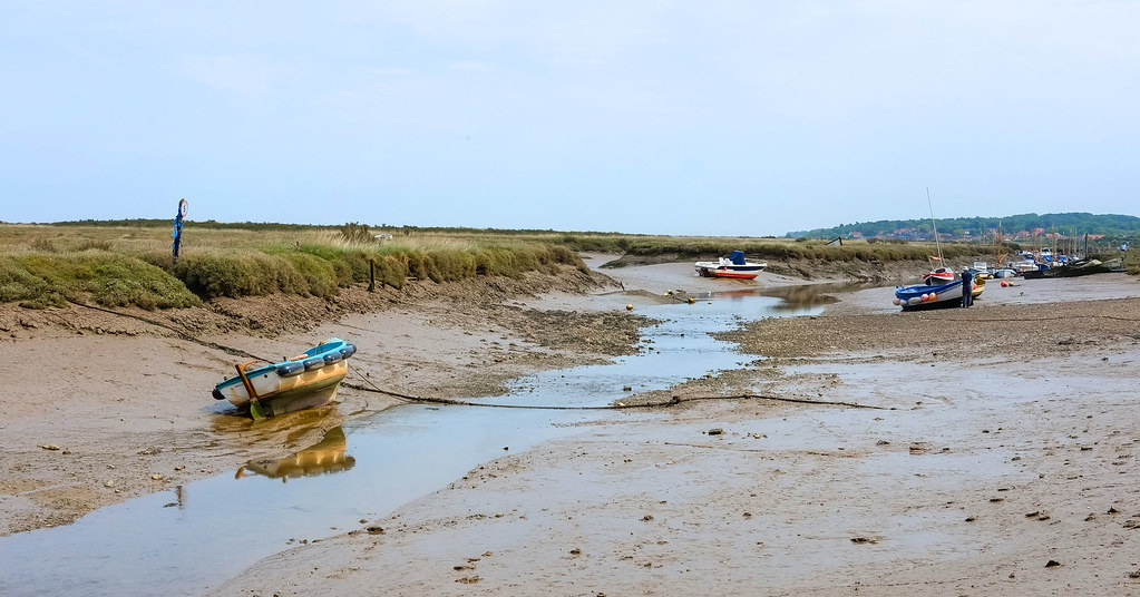
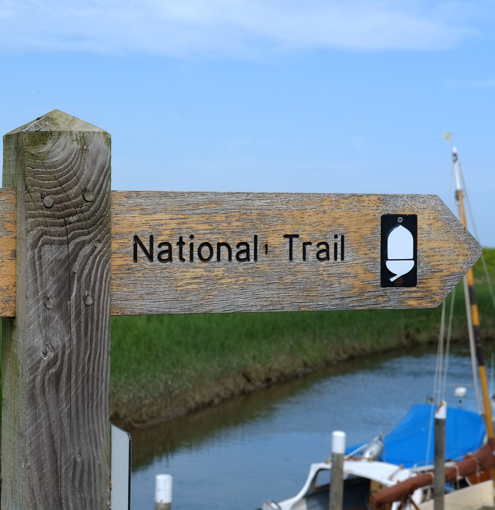
Norfolk Walk Morston Salt Marshes from Morston Quay This short route explores parts of the Mortson Salt Marshes that are accessible on foot. The route starts from the visitor centre (Grid ref. TG006442) which is signed from the A149 Cromer to Hunstanton road in the centre of Morston village. The walk is subject to tides and maybe wet underfoot. Times of tides are available locally and the walk not attempted on a rising tide as there is a danger that you may be cut off or stranded. It must also be stressed that this walk should not be attempted in mist or poor visibility as the lack of landmarks on the marshes can be disorientating
Morston Salt Marshes..Norfolk Coast. by Adam Swaine
Via Flickr:
Norfolk Walk Morston Salt Marshes from Morston Quay This short route explores parts of the Mortson Salt Marshes that are accessible on foot. The route starts from the visitor centre (Grid ref. TG006442) which is signed from the A149 Cromer to Hunstanton road in the centre of Morston village. The walk is subject to tides and maybe wet underfoot. Times of tides are available locally and the walk not attempted on a rising tide as there is a danger that you may be cut off or stranded. It must also be stressed that this walk should not be attempted in mist or poor visibility as the lack of landmarks on the marshes can be disorientating
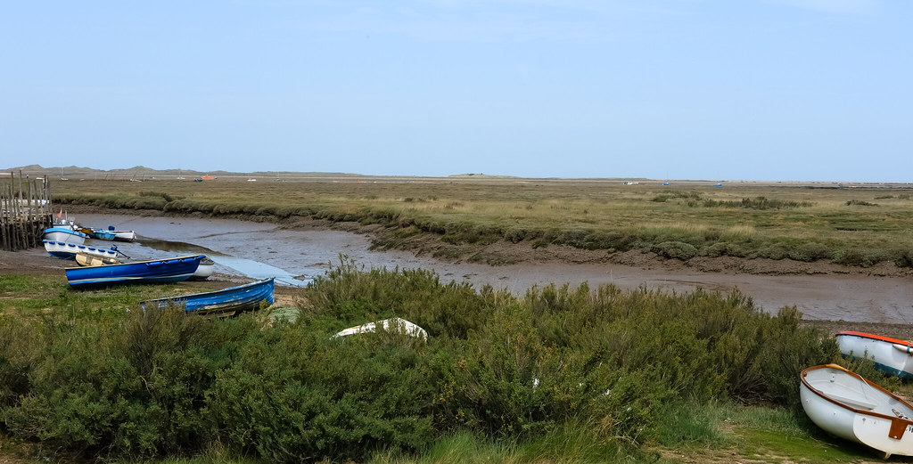
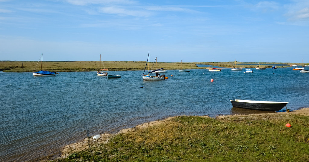
Morston Salt Marshes Norfolk by Adam Swaine
Via Flickr:
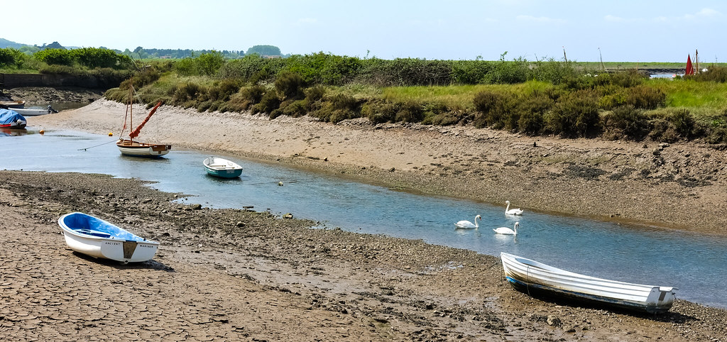
Morston lies within Blakeney National Nature Reserve, which also includes Blakeney Point and Stiffkey Marshes. With its big skies, haunting marshes, meandering tidal creeks and wide open sandy beaches, it is one of the largest areas of undeveloped coastal habitats of its type in Europe.
Blakeney Harbour North Norfolk by Adam Swaine
Via Flickr:
Morston Quay National Trust… Blakeney National Nature Reserve.

Dusk on the Glaven @ Blakeney North Norfolk by Adam Swaine
Via Flickr:
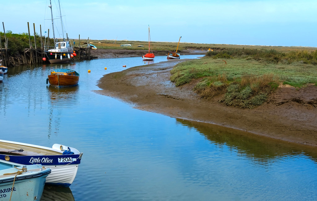
River Glaven, snaking its way through Blakeney - Norfolk UK Blakeney: Glaven Estuary

Blakeney National Nature Reserve Norfolk.. by Adam Swaine
Via Flickr:
River Glaven..The River Glaven flows for 17 km through one of the most beautiful valleys in England. Rising from tiny headwaters in lower Bodham and Baconsthorpe, the main river begins just below Selbrigg Pond where three streams combine at the outfall. Thereafter, it descends through wooded hills of glacial debris and passes through lush countryside and picturesque flint villages. Finally, the river meets the sea behind Blakeney Point. The Glaven is surrounded by arable land, coniferous plantations, grazing meadows and wetlands. The river is a haven for wildlife.

Morston Marsh …Blakeney Harbour NT by Adam Swaine
Via Flickr:
A rich area for wildlife Morston lies within Blakeney National Nature Reserve, which also includes Blakeney Point and Stiffkey Marshes. With its big skies, haunting marshes, meandering tidal creeks and wide open sandy beaches, it is one of the largest areas of undeveloped coastal habitats of its type in Europe..
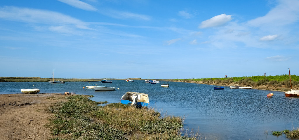
BURNHAM OVERY STAITHE - River Burn by Adam Swaine
Via Flickr:
Burnham Overy Staithe PE31 8HN..Burnham Overy is made up of two settlements, Burnham Overy Town the original village adjacent to the parish church and Burnham Overy Staithe, a rather larger settlement about 1 mile away and next to the creek-side harbour. Historically Burnham Overy which lies on the River Burn was the port for the surrounding villages of the Burnhams. Until the end of the middle ages, trading ships were able to reach the village, however with silting of the river, commercial traffic switched to the downstream Staithe. Between Burnham Overy Staithe and the sea, a network of tidal creeks reach out trough marshes that fringe this stretch of coast, and finally reach the sea by passing through a gap in the sand dunes known locally as Burnham Harbour. Small boats can reach Burnham Overy Staithe through this gap and creek. Today Burnham Overy Staithe, and the associated harbour, is a major recreational sailing centre. There is a comprehensive chandlery on the quayside. It is also the point of departure for boats out to the Scolt Head Island National Nature Reserve
River Burn Norfolk Coast by Adam Swaine
Via Flickr:
The chalk-fed River Burn..flows through a low-lying catchment for 12.1 km before discharging into the salt marshes of Holkham National Nature Reserve (NNR). Its source is close to the village of South Creake, and from here it travels through North Creake and Burnham Thorpe, before widening a little and reaching two watermills – Union Mill and Lower Mill – at Burnham Overy. From here, the Burn widens further and enters Overy saltmarshes, where it eventually flows out to sea.
Walks along the River Glaven Norfolk by Adam Swaine
Via Flickr:
Cley and Salthouse Marshes..Cley and Salthouse Marshes is one of the country’s most popular birdwatching sites, attracting more than 110,000 human visitors each year. The six hides (four of which are accessible via boardwalks) give fantastic views across pools and scrapes that are specially managed to attract breeding and passage birds. The award-winning visitor centre features interactive interpretation, regularly changing exhibitions, and a well-stocked gift and book shop.
Blakeney Quay Norfolk by Adam Swaine
Via Flickr:
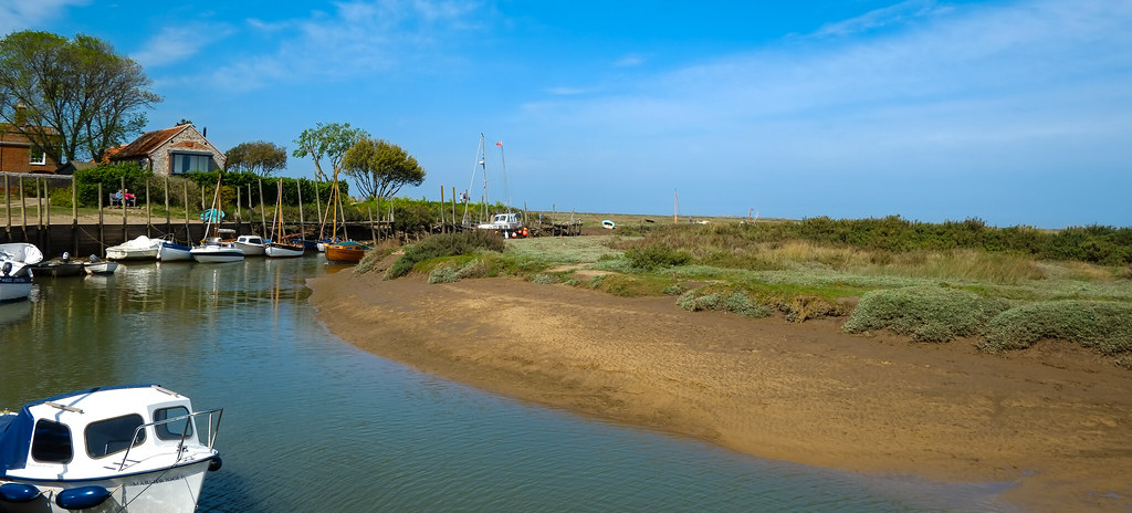
Blakeney National Nature Reserve is an internationally important nature reserve bequest to the National Trust in 1912. The area is home to a varied range of flora and fauna with Blakeney Point home to a breeding seal and tern colony. This unspoilt stretch of Norfolk coastline offers uninterrupted wide open spaces and breath taking views. Blakeney village and nature reserve is a beautiful and peaceful place to visit
River Glaven @ Blakeney Norfolk by Adam Swaine
Via Flickr:
The River Glaven in the eastern English county of Norfolk is 10.5 mi long and flows through picturesque North Norfolk countryside to the North Sea. Rising from a tiny headwater in Bodham the river starts 2+1⁄2 miles before Selbrigg Pond where three small streams combine
River Burn & Salt Marshes Norfolk. by Adam Swaine
Via Flickr:
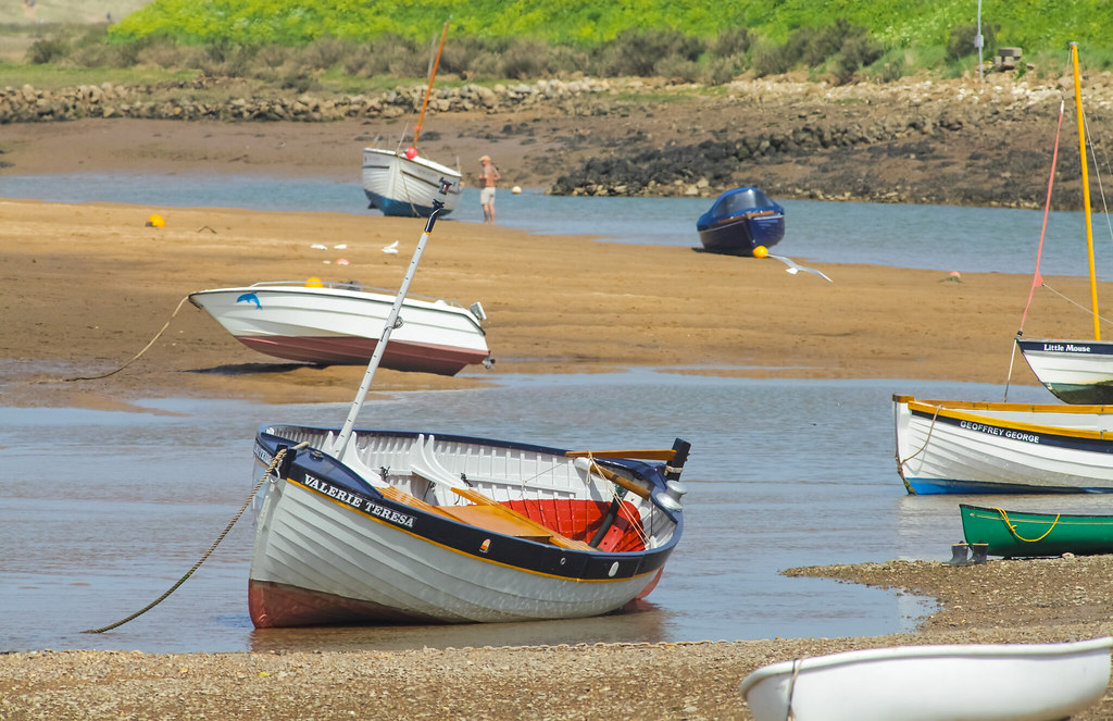
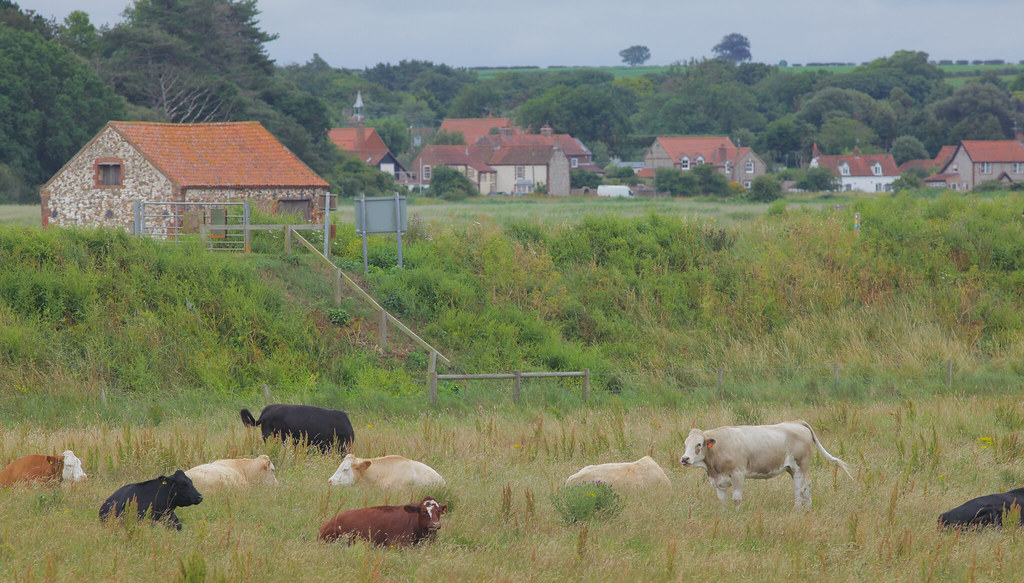
Discover the Unique Salt Marshes of North Norfolk.. North Norfolk is well known for its unique landscape of mudflats and saltmarshes. Norfolk’s mudflats are largely concentrated in the Wash and saltmarshes are found along the north coast of the county between Holme and Salthouse. These areas are not only known for their breathtaking beauty but also for a place to see some of the best wildlife. Throughout the year, the scenery transforms and there is always something new to enjoy, from migrating birds to an array of plant life. Burnham Overy Staithe. Burnham Overy Staithe lies between Holkham and Burnham Norton on the north Norfolk coast. ‘Staithe’ traditionally means 'landing place’, and 'overy’ means 'over the water’. A mile of so inland, the original settlement was Burnham Overy Town which was once a busy port situated on the River Burn. Burnham Overy Staithe has only been in existence since WW2. Walk out along the Norfolk Coast Path, over the marshes and towards the dunes. As you approach the sea, the River Burn spreads out into numerous tidal creeks, which wind their way through the saltmarshes

Thornham Harbour Norfolk Wildlife Trust by Adam Swaine
Via Flickr:
Holme Dunes National Nature Reserve..The Holme Dunes NNR includes the whole of Ragged Marsh salt marsh, and extends south to include all of Thornham Harbour where it lies beside Staithe Lane. It can be accessed via the Coast Path near the visitor centre (but not easily, if at all, in a wheelchair), or from Thornham village by car. Thornham Harbour is an excellent birding venue, with waders and wildfowl on the seaward side, birds such as wheatears, twite and linnets mainly on the landward side, and marsh harriers almost ever-present over the grazing marshes
Salt Marsh @ Thornham Norfolk… by Adam Swaine
Via Flickr:
Thornham Harbour where it lies beside Staithe Lane. It can be accessed via the Coast Path near the visitor centre (but not easily, if at all, in a wheelchair), or from Thornham village by car. Thornham Harbour is an excellent birding venue, with waders and wildfowl on the seaward side, birds such as wheatears, twite and linnets mainly on the landward side, and marsh harriers almost ever-present over the grazing marshes. Increasingly red kite are present overhead, too. Besides the birding, the spectacle of the harbour and saltmarsh being completely covered by the sea at high spring tides is an attraction in itself.
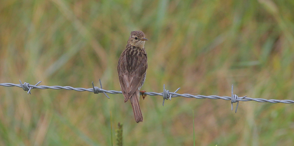
Meadow Pipit by Adam Swaine
Via Flickr:
Meadow pipits can be difficult to spot as their plumage often blends into surrounding vegetation. They have olive-brown upperparts, with broad black streaks on the head, mantle and back. The upperwing is darker with pale edges. Meadow pipits’ tails are dark brown with a green fringe, they have paler underparts, and the underwing is whitish. They have slender bills which are dark brown with a pale base. Eyes are dark brown, and their legs and feet are yellow-brown with a long hind claw. Male and female meadow pipits look similar while juveniles are browner with paler underparts. Their streaks are also not as dark

“Bird on a Wire”…Norfolk by Adam Swaine
Via Flickr:
Meadow pipit..The meadow pipit is a common nesting bird of moorland, heathland and rough grassland. In the autumn and winter, it moves out of upland areas to lowlands where it gathers in small flocks and can be found on farmland and saltmarshes. In the spring, it performs a fluttering, ‘parachute’ display flight. There are 2 million breeding territories in the UK
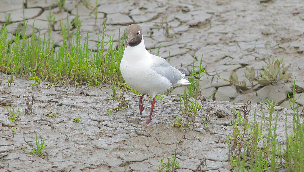
Black-headed gull by Adam Swaine
Via Flickr:
Not really a black-headed bird, more chocolate-brown - in fact, for much of the year, it has a white head. It is most definitely not a ‘seagull’ and is found commonly almost anywhere inland. Black-headed gulls are sociable, quarrelsome, noisy birds, usually seen in small groups or flocks, often gathering into larger parties where there is plenty of food, or when they are roosting

Creeks @ Thornham Norfolk by Adam Swaine
Via Flickr:
We were soon off along the coastal path heading towards Holme, and the Norfolk Wildlife Trust’s reserve at Holme Dunes. At Thornham harbour – really just a few boats moored to some rather ramshackle looking landing stages – the marshes stretch either side of the road that leads to a small raised car park once the site of a large grain store. The channel was deeper then, and much larger boats than the few pleasure craft now here could access this far inland. Not so long ago farming supported most of the communities near here, and the ability for fairly substantial vessels to be able to transport the crop pretty much anywhere must have been invaluable. If you don’t mind getting muddy – and I do mean muddy – you can gather a crop of your own here; samphire

Thornham Nature Reserve by Adam Swaine
Via Flickr:
It also holds a variety of important habitats which support numerous other wildlife species including natterjack toads, butterflies and dragonflies, as well as a large number of interesting plants..lovely walk to the beach